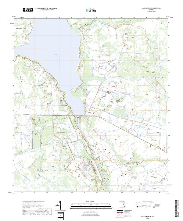
2024 Map of Lake Marian SW
USGS Topo · Published 2024About this map
The eastern shores of Lake Kissimmee and the winding course of the Kissimmee River define this central Florida landscape, where the boundary between Osceola and Polk Counties follows the water's edge. The terrain is characterized by numerous hammocks—distinctive clusters of hardwood trees rising above the surrounding wetlands—such as Turkey Hammock, Wildcat Hammock, and Buzzard Hammock. These features, along with names like Fodderstack Slough and Packingham Slough, reflect the region's ranching and natural history.
Find a feature on this map
40 named features on this map. Tap any name to fly to it.
Don’t see what you’re looking for? This feature index may not catch every label — zoom into the map to look around manually.
Map Details
Editions of this 2024 Lake Marian SW Map
This is the sole edition of this map. No revisions or reprints were ever made.
Other maps of this area

1952 · Lake Weohyakapka SE
USGS Topo · 1:24,000

1952 · Lake Weohyakapka NE
USGS Topo · 1:24,000

1952 · Fort Kissimmee NW
USGS Topo · 1:24,000

1952 · Lake Arbuckle NE
USGS Topo · 1:24,000

1953 · Lake Marian NW
USGS Topo · 1:24,000

1953 · Fort Kissimmee NE
USGS Topo · 1:24,000

1953 · Lake Marian SE
USGS Topo · 1:24,000

1953 · Lake Marian SW
USGS Topo · 1:24,000

1953 · Lake Marian NE
USGS Topo · 1:24,000

1956 · Fort Pierce
USGS Topo · 1:250,000