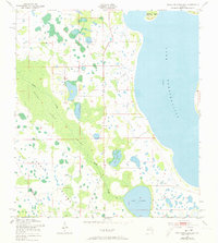
1953 Map of Lake Tohopekaliga
USGS Topo · Published 1973About this map
Lake Tohopekaliga dominates the eastern horizon of this Florida landscape, where the shifting boundary between Osceola and Polk counties meets a complex system of cypress wetlands and interior lakes. The western edge of the quadrangle is defined by the expansive Reedy Creek Swamp and the wandering course of Reedy Creek, illustrating the hydraulic connection between these lowland basins. Cultural development is sparse, centered primarily on the Pleasant Hill Cem located near the lake shore. The map details a wilder Florida before extensive drainage and urbanization, highlighting large natural features such as Johnson Island and Makinson Island, along with smaller water bodies like Lake Russell and Brown Lake. This 1950s survey captures the region's topography just prior to the significant mid-century changes that transformed the Kissimmee River valley.
Find a feature on this map
10 named features on this map. Tap any name to fly to it.
Don’t see what you’re looking for? This feature index may not catch every label — zoom into the map to look around manually.
Map Details
Editions of this 1953 Lake Tohopekaliga Map
5 editions found
Other maps of this area

1953 · Cypress Lake
USGS Topo · 1:24,000

1953 · Dundee
USGS Topo · 1:24,000

1953 · Lake Hatchineha
USGS Topo · 1:24,000

1953 · St Cloud North
USGS Topo · 1:24,000

1953 · St Cloud South
USGS Topo · 1:24,000

1953 · Lake Tohopekaliga
USGS Topo · 1:24,000

1953 · Kissimmee
USGS Topo · 1:24,000

1953 · Intercession City
USGS Topo · 1:24,000

1953 · Davenport
USGS Topo · 1:24,000

1955 · Orlando
USGS Topo · 1:250,000