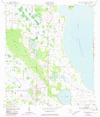
1953 Map of Lake Tohopekaliga
USGS Topo · Published 1981About this map
Lake Tohopekaliga dominates this central Florida landscape, its expansive western shoreline meeting a network of wetlands and creek systems. Mapping by the Corps of Engineers and Geological Survey reveals the intricate hydrology of the Reedy Creek Swamp and the flow of Reedy Creek as it moves south toward the border between Osceola and Polk Counties. The map provides specific detail for local historians, marking the Pleasant Hill Cem and interior water bodies like Brown Lake and Lake Russell. Distinctive landforms such as Makinson Island and Johnson Island stand apart from the mainland, illustrating the region's natural geography before the intensification of modern suburban development. Purple revisions from later aerial photography show emerging road networks and residential footprints, contrasting the mid-century wilderness with late-twentieth-century growth.
Find a feature on this map
10 named features on this map. Tap any name to fly to it.
Don’t see what you’re looking for? This feature index may not catch every label — zoom into the map to look around manually.
Map Details
Editions of this 1953 Lake Tohopekaliga Map
5 editions found
Other maps of this area

1953 · Cypress Lake
USGS Topo · 1:24,000

1953 · Dundee
USGS Topo · 1:24,000

1953 · Lake Hatchineha
USGS Topo · 1:24,000

1953 · St Cloud North
USGS Topo · 1:24,000

1953 · St Cloud South
USGS Topo · 1:24,000

1953 · Lake Tohopekaliga
USGS Topo · 1:24,000

1953 · Kissimmee
USGS Topo · 1:24,000

1953 · Intercession City
USGS Topo · 1:24,000

1953 · Davenport
USGS Topo · 1:24,000

1955 · Orlando
USGS Topo · 1:250,000