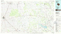
1986 Map of Lamesa
USGS Topo · Published 1986About this map
The high plains of West Texas meet the rolling breaks of the Caprock in this 1986 survey, dominated by the agricultural hub of Lamesa and the emerging energy infrastructure of the Southern High Plains. The landscape is defined by the deep incisions of Sulphur Springs Draw and the Colorado River, which feeds into the prominent Lake J B Thomas at the southeastern corner. This era shows the region as a major petroleum producer, with extensive operations visible at the Diamond M Oil Field, Jo Mill Oil Field, and Ackerly Oil Field.
Find a feature on this map
74 named features on this map. Tap any name to fly to it.
Don’t see what you’re looking for? This feature index may not catch every label — zoom into the map to look around manually.
Map Details
Editions of this 1986 Lamesa Map
2 editions found
Other maps of this area

1942 · Big Spring North
USGS Topo · 1:62,500

1950 · Cedar Bend
USGS Topo · 1:24,000

1951 · Ira SW
USGS Topo · 1:24,000

1951 · Ira
USGS Topo · 1:24,000

1951 · Dunn
USGS Topo · 1:24,000

1951 · Ira NW
USGS Topo · 1:24,000

1951 · Vincent
USGS Topo · 1:24,000

1952 · Cuthbert
USGS Topo · 1:24,000

1952 · Snyder
USGS Topo · 1:24,000

1952 · Ira NE
USGS Topo · 1:24,000