
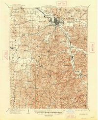
1909 Map of Lancaster
USGS Topo · Published 1938About this map
The city of Lancaster serves as the focal point of this early twentieth-century survey, situated at the junction of the Cincinnati and Muskingum Valley RR and the Columbus Hocking Valley and Toledo RR. The landscape south of the city is marked by the Abandoned Hocking Canal, which traces the Hocking River valley through Sugargrove toward Rockbridge. This era represents a significant transition in transport as the old canal system gave way to heavy rail dominance, including the Pennsylvania System.
Find a feature on this map
70 named features on this map. Tap any name to fly to it.
Don’t see what you’re looking for? This feature index may not catch every label — zoom into the map to look around manually.
Map Details
Editions of this 1909 Lancaster Map
2 editions found
Other maps of this area

1904 · Zaleski
USGS Topo · 1:62,500

1906 · Chillicothe
USGS Topo · 1:62,500

1907 · Zaleski
USGS Topo · 1:62,500

1907 · Logan
USGS Topo · 1:62,500

1907 · Lancaster
USGS Topo · 1:62,500

1907 · Thurston
USGS Topo · 1:62,500

1908 · Chillicothe
USGS Topo · 1:62,500

1909 · Thornville
USGS Topo · 1:62,500

1909 · Logan
USGS Topo · 1:62,500

1909 · Thurston
USGS Topo · 1:62,500