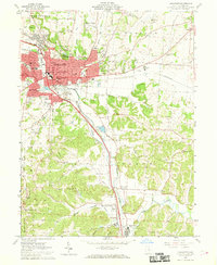
1961 Map of Lancaster
USGS Topo · Published 1969About this map
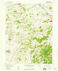
Lancaster serves as the industrial and civic anchor of this 1961 survey, situated at the confluence of the Hocking River and Baldwin Run. The map illustrates a city in mid-century transition, featuring established institutions like the State Industrial Sch and the County Infirmary alongside burgeoning developments like Wacker Heights and Cedar Heights. Prominent landmarks such as Mt Pleasant in Rising Park dominate the local topography, while the surrounding landscape is defined by the corridors of the Pennsylvania and Chesapeake and Ohio railroads.
Find a feature on this map
74 named features on this map. Tap any name to fly to it.
Don’t see what you’re looking for? This feature index may not catch every label — zoom into the map to look around manually.
Map Details
Editions of this 1961 Lancaster Map
4 editions found
Other maps of this area

1907 · Logan
USGS Topo · 1:62,500

1907 · Lancaster
USGS Topo · 1:62,500

1907 · Thurston
USGS Topo · 1:62,500

1909 · Thornville
USGS Topo · 1:62,500

1909 · Lancaster
USGS Topo · 1:62,500

1909 · Logan
USGS Topo · 1:62,500

1909 · Thurston
USGS Topo · 1:62,500

1947 · Columbus
USGS Topo · 1:250,000

1958 · Carroll
USGS Topo · 1:24,000
1958 · Amanda
USGS Topo · 1:24,000