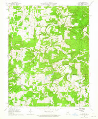
1963 Map of Lecoma
USGS Topo · Published 1964About this map
Lecoma sits near the crossing of Phelps and Dent counties, serving as a focal point for this rural Missouri landscape. The terrain is defined by a network of karst features and seasonal drainages, most notably the Dry Fork and Little Dry Fork which carve through the Cold Spring and Watkins townships. Local industry and land use are evident in the scattered quarries and distinctive Charcoal Ovens, indicating a history of resource extraction and processing.
Find a feature on this map
37 named features on this map. Tap any name to fly to it.
Don’t see what you’re looking for? This feature index may not catch every label — zoom into the map to look around manually.
Map Details
Editions of this 1963 Lecoma Map
2 editions found
Other maps of this area

1912 · Rolla
USGS Topo · 1:62,500

1928 · Meramec Spring
USGS Topo · 1:62,500

1937 · Edgar Springs
USGS Topo · 1:48,000

1941 · Salem
USGS Topo · 1:62,500

1945 · Salem
USGS Topo · 1:62,500

1945 · Edgar Springs
USGS Topo · 1:62,500

1949 · Rolla
USGS Topo · 1:250,000

1949 · Meramec Spring
USGS Topo · 1:62,500
1950 · Yancy Mills
USGS Topo · 1:24,000
1951 · Yancy Mills
USGS Topo · 1:24,000