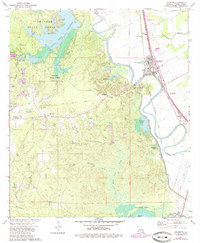
1972 Map of Lecompte
USGS Topo · Published 1979About this map
Alexander State Forest dominates the northwestern terrain of this Rapides Parish region, where the Indian Creek Reservoir and a State Fish Hatchery suggest a landscape managed for both timber and water resources. The town of Lecompte serves as the primary hub, situated at the junction of the Texas and Pacific and Chicago Rock Island and Pacific railroads. This transportation corridor follows the path of Bayou Boeuf, illustrating how the rail lines were engineered to capitalize on the natural drainage and flat topography of the alluvial plain.
Find a feature on this map
53 named features on this map. Tap any name to fly to it.
Don’t see what you’re looking for? This feature index may not catch every label — zoom into the map to look around manually.
Map Details
Editions of this 1972 Lecompte Map
3 editions found
Other maps of this area

1935 · Turkey Creek
USGS Topo · 1:62,500

1935 · Lecompte
USGS Topo · 1:62,500

1942 · Oakdale
USGS Topo · 1:62,500

1949 · Glenmora
USGS Topo · 1:31,680

1949 · Turkey Creek
USGS Topo · 1:62,500

1952 · Lake Charles
USGS Topo · 1:250,000

1953 · Alexandria
USGS Topo · 1:250,000

1954 · Lake Charles
USGS Topo · 1:250,000

1955 · Alexandria
USGS Topo · 1:250,000

1956 · Forest Hill
USGS Topo · 1:62,500