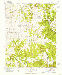
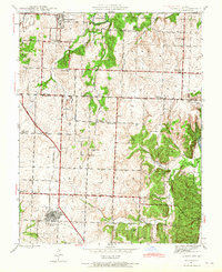
1953 Map of Leesville
USGS Topo · Published 1955About this map
The South Grand River and Osage River converge in this corner of rural Missouri, where the landscape is defined by the winding paths of Tebo Creek and its many tributaries. This mid-century survey captures a pattern of dispersed rural living centered on community schools and churches, several of which were named for the creeks they served. Small-scale mining activity is evident in the northwestern and eastern sections of the quadrangle, including a notable Coal deposit near the border. The unusual name of Tightwad appears as a small settlement along the central road network, contrasting with the more established community of Leesville to the northeast. Many of the landmarks here, such as Hortense Sch and Mound Springs Sch, provide specific geographical anchors for genealogists researching family history in the Henry and Benton County borderlands.
Find a feature on this map
28 named features on this map. Tap any name to fly to it.
Don’t see what you’re looking for? This feature index may not catch every label — zoom into the map to look around manually.
Map Details
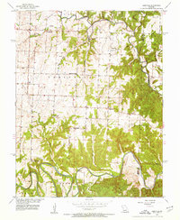
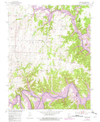
Editions of this 1953 Leesville Map
3 editions found
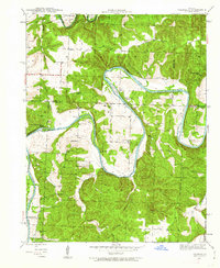
Other maps of this area

1887 · Clinton
USGS Topo · 1:125,000

1887 · Warsaw
USGS Topo · 1:125,000

1894 · Warsaw
USGS Topo · 1:125,000

1894 · Clinton
USGS Topo · 1:125,000

1936 · Shawnee Bend
USGS Topo · 1:24,000
1941 · Valhalla
USGS Topo · 1:24,000
1941 · Lowry City
USGS Topo · 1:24,000

1945 · Fristoe
USGS Topo · 1:62,500
1945 · Lowry City
USGS Topo · 1:24,000

1945 · Valhalla
USGS Topo · 1:24,000