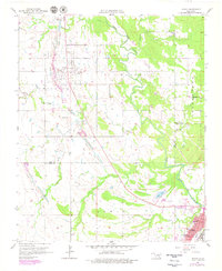
1957 Map of Lehigh
USGS Topo · Published 1979About this map
Extensive Strip Mine operations dominate the landscape between Lehigh and Phillips, revealing the heavy industrial footprint on Coal County during the mid-20th century. The settlement at Lehigh is flanked by the Lehigh Cem and Old Lehigh Cem, reflecting the deep roots of this mining community. To the south, the terrain shifts into Atoka County, marked by the waters of Atoka Lake and the Atoka Landing Field. The map captures a transition from industrial coal extraction to more rural areas characterized by dispersed landmarks like Macedonia Ch and Macedonia Sch. Numerous creeks, including Muddy Boggy Creek and Coal Creek, carve through the region, while the southern edge shows the growth of Atoka near its local schools and infrastructure. This document provides an essential record of the local infrastructure and the environmental impact of the region's mining history.
Find a feature on this map
29 named features on this map. Tap any name to fly to it.
Don’t see what you’re looking for? This feature index may not catch every label — zoom into the map to look around manually.
Map Details
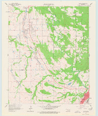
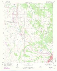
Editions of this 1957 Lehigh Map
4 editions found
Other maps of this area

1896 · Coalgate
USGS Topo · 1:125,000

1899 · Coalgate
USGS Topo · 1:125,000

1899 · Atoka
USGS Topo · 1:125,000

1900 · Atoka
USGS Topo · 1:125,000

1900 · Coalgate
USGS Topo · 1:125,000

1956 · Stringtown
USGS Topo · 1:24,000

1957 · Coalgate
USGS Topo · 1:24,000

1957 · Lehigh
USGS Topo · 1:24,000

1957 · Coalgate SE
USGS Topo · 1:24,000

1957 · Bruno
USGS Topo · 1:24,000