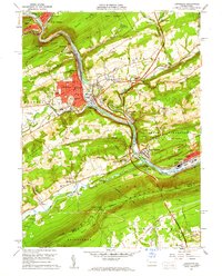
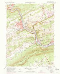
1960 Map of Lehighton
USGS Topo · Published 1961About this map
The Lehigh River carves a deep path through the coal region of Carbon County, anchoring a landscape defined by industry and complex topography. In Lehighton, the urban grid is densely packed with local institutions like the Third Ward Sch and First Ward Sch, while the riverbanks are dominated by the competing infrastructure of the Lehigh Valley RR and the Central RR of New Jersey. The intricate rail yards at Packerton and the strategic Lizard Creek Junction illustrate the era's dependence on rail for transport through the water gaps. To the south, the ridge of Blue Mountain remains largely undeveloped, marked only by the Appalachian Trail and the passage at Lehigh Furnace Gap. Small settlements like Ashfield, Balliet, and Germans dot the agricultural valleys, showing the persistent rural character surrounding the industrial river corridor.
Find a feature on this map
85 named features on this map. Tap any name to fly to it.
Don’t see what you’re looking for? This feature index may not catch every label — zoom into the map to look around manually.
Map Details
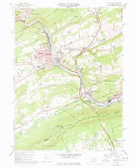
Editions of this 1960 Lehighton Map
6 editions found
Other maps of this area

1889 · Hazleton
USGS Topo · 1:62,500

1891 · Hazleton
USGS Topo · 1:62,500

1893 · Hazleton
USGS Topo · 1:62,500

1902 · Slatington
USGS Topo · 1:62,500

1909 · Hamburg
USGS Topo · 1:62,500

1911 · Hamburg
USGS Topo · 1:62,500

1922 · Mauch Chunk
USGS Topo · 1:62,500

1924 · Mauch Chunk
USGS Topo · 1:62,500

1937 · Allentown West
USGS Topo · 1:48,000

1942 · Allentown West
USGS Topo · 1:62,500