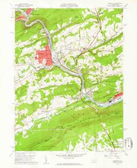
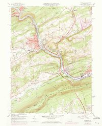
1960 Map of Lehighton
USGS Topo · Published 1961About this map
The Lehighton and Jim Thorpe corridor follows the steep passage of the Lehigh River through the ridges of Carbon County. This survey shows the region as a major transportation hub, where the Central RR of New Jersey and the Lehigh Valley RR parallel the water, serving the industrial borough of Lehighton and its rail yards at Packerton. High above the river valley, the Appalachian Trail traces the crest of Blue Mountain, passing through the State Game Lands No 217 near Lehigh Furnace Gap. The map captures a mix of industrial infrastructure, including the Lehighton Airport and various sandpits, alongside established rural communities like Ashfield and Parryville. Local history is preserved in landmarks such as the Dinkey Memorial Cem and numerous ward-specific schools that defined the urban centers of the mid-century.
Find a feature on this map
91 named features on this map. Tap any name to fly to it.
Don’t see what you’re looking for? This feature index may not catch every label — zoom into the map to look around manually.
Map Details
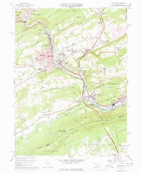
Editions of this 1960 Lehighton Map
6 editions found
Other maps of this area

1889 · Hazleton
USGS Topo · 1:62,500

1891 · Hazleton
USGS Topo · 1:62,500

1893 · Hazleton
USGS Topo · 1:62,500

1902 · Slatington
USGS Topo · 1:62,500

1909 · Hamburg
USGS Topo · 1:62,500

1911 · Hamburg
USGS Topo · 1:62,500

1922 · Mauch Chunk
USGS Topo · 1:62,500

1924 · Mauch Chunk
USGS Topo · 1:62,500

1937 · Allentown West
USGS Topo · 1:48,000

1942 · Allentown West
USGS Topo · 1:62,500