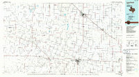
1985 Map of Levelland
USGS Topo · Published 1986About this map
The Levelland and Slaughter Oil and Gas Field dominates the southern landscape of this West Texas region, illustrating the heavy industrial footprint of petroleum extraction during the mid-1980s. This survey captures a transition in the Llano Estacado, where vast energy developments like the Pettit San Andreas Oil Field and Smyer Oil Field operate alongside historic agricultural settlements. The terrain is defined by dry draws and saline basins, most notably the Muleshoe National Wildlife Refuge protecting Upper Pauls Lake and Lower Pauls Lake.
Find a feature on this map
54 named features on this map. Tap any name to fly to it.
Don’t see what you’re looking for? This feature index may not catch every label — zoom into the map to look around manually.
Map Details
Editions of this 1985 Levelland Map
2 editions found
Other maps of this area

1954 · Lubbock
USGS Topo · 1:250,000

1954 · Plainview
USGS Topo · 1:250,000

1954 · Clovis
USGS Topo · 1:250,000

1954 · Brownfield
USGS Topo · 1:250,000

1956 · Shallowater
USGS Topo · 1:24,000

1957 · New Home
USGS Topo · 1:62,500

1957 · Lubbock West
USGS Topo · 1:24,000

1957 · Lubbock
USGS Topo · 1:62,500

1957 · Anton
USGS Topo · 1:62,500

1957 · Arch
USGS Topo · 1:62,500