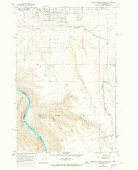
1958 Map of Lewiston Orchards South
USGS Topo · Published 1973About this map
Lewiston Orchards serves as the primary residential hub at the northern edge of this study, where suburban expansion meets the deeply incised basalt plateaus of Nez Perce County. The landscape drops sharply from the agricultural flats into the Snake River canyon, a major geographical boundary between Washington and Idaho. This 1958 survey, updated with 1972 aerial revisions, captures the transition from settled orchard lands to the steep, dissected drainages of Tenmile Canyon and Short Canyon.
Find a feature on this map
23 named features on this map. Tap any name to fly to it.
Don’t see what you’re looking for? This feature index may not catch every label — zoom into the map to look around manually.
Map Details
Editions of this 1958 Lewiston Orchards South Map
4 editions found

Other maps of this area

1944 · Anatone
USGS Topo · 1:62,500

1945 · Clarkston
USGS Topo · 1:62,500

1946 · Limekiln Rapids
USGS Topo · 1:62,500

1946 · Anatone
USGS Topo · 1:62,500

1948 · Clarkston
USGS Topo · 1:62,500

1955 · Pullman
USGS Topo · 1:250,000

1958 · Pullman
USGS Topo · 1:250,000

1958 · Lapwai
USGS Topo · 1:24,000

1958 · Sweetwater
USGS Topo · 1:24,000

1958 · Lewiston Orchards North
USGS Topo · 1:24,000