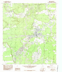
1984 Map of Liberty
USGS Topo · Published 1985About this map
The Trinity River snakes in a tight, serpentine pattern across this southeast Texas landscape, defining the character of Liberty and its surrounding communities. The city serves as a hub of activity, supported by the Port of Liberty and adjacent industrial infrastructure, including an active Oil Field and numerous Gravel Pits that suggest a robust local resource economy. To the north and south, smaller settlements like Kenefick, South Liberty, and Ames are interspersed among a dense network of bayous and oxbow lakes, such as Horseshoe Lake, Josie Lake, and Snag Lake. The terrain is generally low-lying, punctuated by family-named landmarks like Graveyard Hill and Daniel Lake, while the eastern portion of the sheet is dominated by extensive marshlands including Beards Marsh and Turkey Creek Marsh. This survey documents a critical junction of river-based commerce and inland development during the late 1970s and early 1980s.
Find a feature on this map
33 named features on this map. Tap any name to fly to it.
Don’t see what you’re looking for? This feature index may not catch every label — zoom into the map to look around manually.
Map Details
Editions of this 1984 Liberty Map
2 editions found
Other maps of this area

1943 · Liberty
USGS Topo · 1:125,000

1950 · Houston
USGS Topo · 1:250,000

1954 · Beaumont
USGS Topo · 1:250,000

1955 · Daisetta
USGS Topo · 1:62,500

1955 · Liberty
USGS Topo · 1:62,500

1956 · Houston
USGS Topo · 1:250,000

1957 · Beaumont
USGS Topo · 1:250,000

1961 · Shiloh
USGS Topo · 1:24,000
1961 · Sheeks
USGS Topo · 1:24,000
1961 · Moss Bluff
USGS Topo · 1:24,000