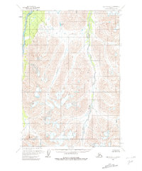
1958 Map of Lime Hills C-1
USGS Topo · Published 1981About this map
South Fork Kuskokwim River defines the western edge of this Alaskan landscape, captured during aerial surveys in the mid-1950s. The topography is dominated by dramatic elevation changes, where the glacial drainage systems of the Styx River and Crystal Creek carve through the high terrain. This 1:63,360 scale study provides a precise look at the hydrography of the region before any modern development, centering on remote water features like Jimmy Lake. The map represents a purely natural environment, devoid of roads, trails, or man-made settlements at the time of field annotation in 1958, highlighting the raw geography of the Bethel area.
Find a feature on this map
7 named features on this map. Tap any name to fly to it.
Don’t see what you’re looking for? This feature index may not catch every label — zoom into the map to look around manually.
Map Details
Editions of this 1958 Lime Hills C-1 Map
3 editions found
Other maps of this area

1949 · Tyonek
USGS Topo · 1:250,000

1951 · Tyonek
USGS Topo · 1:250,000

1951 · Lime Hills
USGS Topo · 1:250,000

1958 · Tyonek B-8
USGS Topo · 1:63,360

1958 · Tyonek C-8
USGS Topo · 1:63,360

1958 · Tyonek D-8
USGS Topo · 1:63,360

1958 · Tyonek
USGS Topo · 1:250,000

1958 · Lime Hills B-1
USGS Topo · 1:63,360
1958 · Lime Hills D-1
USGS Topo · 1:63,360

1958 · Lime Hills C-1
USGS Topo · 1:63,360