
1955 Map of Lincoln
USGS Topo · Published 1967About this map
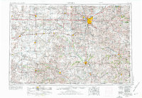
Lincoln serves as the metropolitan hub for a vast agricultural landscape defined by the Salt Creek and Big Blue River drainage systems. In the mid-1950s, the operational footprint of Lincoln Air Force Base stands out on the city's northwest edge, while a series of reservoirs like Branched Oak Lake and Pawnee Lake begin to alter the hydrology of the plains. The map records a dense network of transport, with the Burlington Northern and Union Pacific railroads connecting established grain-handling towns such as Seward, York, and Beatrice.
Find a feature on this map
119 named features on this map. Tap any name to fly to it.
Don’t see what you’re looking for? This feature index may not catch every label — zoom into the map to look around manually.
Map Details
Editions of this 1955 Lincoln Map
5 editions found
Other maps of this area

1888 · Hiawatha
USGS Topo · 1:125,000

1889 · Seneca
USGS Topo · 1:125,000

1889 · Marysville
USGS Topo · 1:125,000

1892 · Concordia
USGS Topo · 1:125,000

1893 · Washington
USGS Topo · 1:125,000

1893 · Fremont
USGS Topo · 1:125,000

1894 · Seneca
USGS Topo · 1:125,000

1894 · Mankato
USGS Topo · 1:125,000

1894 · Hiawatha
USGS Topo · 1:125,000

1894 · Marysville
USGS Topo · 1:125,000