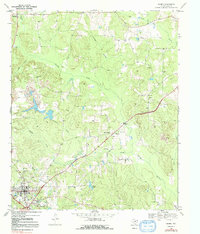
1969 Map of Linden
USGS Topo · Published 1992About this map
Linden serves as a focal point for this survey of Cass County, showing a landscape defined by small rural communities and winding creek systems. The town is marked by local landmarks like the Rodeo Ground and Lions Park, while a network of secondary roads connects it to outlying settlements such as New Colony and Roach. Family history is woven into the terrain through several country churches and cemeteries, including Center Grove Ch and Echols Cem.
Find a feature on this map
38 named features on this map. Tap any name to fly to it.
Don’t see what you’re looking for? This feature index may not catch every label — zoom into the map to look around manually.
Map Details
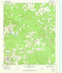
Editions of this 1969 Linden Map
2 editions found
Other maps of this area

1907 · Atlanta
USGS Topo · 1:62,500

1910 · Linden
USGS Topo · 1:62,500

1910 · Atlanta
USGS Topo · 1:62,500

1944 · Kildare
USGS Topo · 1:62,500

1948 · Kildare
USGS Topo · 1:62,500

1953 · Texarkana
USGS Topo · 1:250,000

1956 · Texarkana
USGS Topo · 1:250,000

1956 · Tyler
USGS Topo · 1:250,000

1961 · Cunningham Creek
USGS Topo · 1:24,000

1962 · Lanier
USGS Topo · 1:24,000