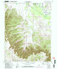
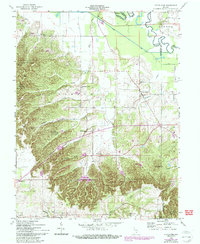
1958 Map of Little York
USGS Topo · Published 1993About this map
Little York and the nearby hamlet of Pumpkin Center serve as the primary hubs in this section of rural Washington County during the mid-to-late 20th century. The landscape is defined by the sharp transition between the alluvial flats of the Muscatatuck River and the deeply dissected ridges of the Jackson-Washington State Forest. Numerous family and community landmarks are scattered throughout the hills, including Sleepy Hollow Cem, Mt Hebron Ch, and Mt Carmel Ch, reflecting a long-established settlement pattern along the ridgelines and hollows.
Find a feature on this map
41 named features on this map. Tap any name to fly to it.
Don’t see what you’re looking for? This feature index may not catch every label — zoom into the map to look around manually.
Map Details
Editions of this 1958 Little York Map
6 editions found
Other maps of this area

1947 · Scottsburg
USGS Topo · 1:24,000

1949 · Henryville
USGS Topo · 1:24,000

1950 · Salem
USGS Topo · 1:24,000

1953 · Kossuth
USGS Topo · 1:24,000

1955 · South Boston
USGS Topo · 1:24,000

1956 · Vincennes
USGS Topo · 1:250,000

1956 · Louisville
USGS Topo · 1:250,000

1957 · Vincennes
USGS Topo · 1:250,000

1958 · Vincennes
USGS Topo · 1:250,000

1958 · Little York
USGS Topo · 1:24,000