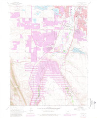
1965 Map of Littleton
USGS Topo · Published 1980About this map
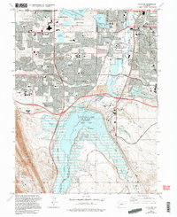
The South Platte River corridor south of Denver undergoes significant transformation in this mid-century survey, most notably with the establishment of the Chatfield Lake reservoir and its surrounding State Recreation Area. This project dramatically altered the landscape near the Jefferson and Douglas County line, where the river's path is constrained by the rising Hogback to the west. To the north, the suburban expansion of Littleton is in full view, featuring landmarks like the Centennial Racetrack and the Woodlawn Shopping Center.
Find a feature on this map
65 named features on this map. Tap any name to fly to it.
Don’t see what you’re looking for? This feature index may not catch every label — zoom into the map to look around manually.
Map Details
Editions of this 1965 Littleton Map
5 editions found
Other maps of this area

1890 · East Denver
USGS Topo · 1:125,000

1893 · Platte Canyon
USGS Topo · 1:125,000

1894 · Castle Rock
USGS Topo · 1:125,000

1899 · West Denver
USGS Topo · 1:125,000

1913 · Castle Rock
USGS Topo · 1:125,000

1935 · East Denver Nos. 3 and 4
USGS Topo · 1:48,000

1938 · Morrison
USGS Topo · 1:24,000

1940 · Englewood
USGS Topo · 1:31,680

1940 · Castle Rock
USGS Topo · 1:62,500

1941 · Fort Logan
USGS Topo · 1:31,680