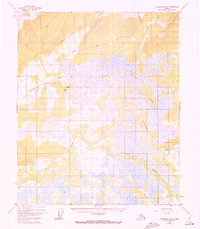
1951 Map of Livengood A-5
USGS Topo · Published 1972About this map
The low-lying wetlands of the Interior define this landscape, where the meandering courses of the Tolovana River, Tatalina River, and Chatanika River converge. This 1951 survey, revised in the early 1970s, documents the settlement of Minto (New) along with its essential Landing Strip, providing a clear look at transportation in a region where water and air travel superseded roads. To the north, a solitary Cabin and a network of Tractor Trails suggest seasonal access through the higher ground near Uncle Sam Creek. The intricate network of lakes and sloughs, including Cod Lake and Idaho Creek, illustrates the complex hydrology of the Tanana Valley before modern development altered local drainage patterns.
Find a feature on this map
11 named features on this map. Tap any name to fly to it.
Don’t see what you’re looking for? This feature index may not catch every label — zoom into the map to look around manually.
Map Details
Editions of this 1951 Livengood A-5 Map
4 editions found
Other maps of this area

1945 · Livengood
USGS Topo · 1:250,000

1949 · Fairbanks D-4
USGS Topo · 1:63,360

1950 · Fairbanks
USGS Topo · 1:250,000

1950 · Fairbanks D-5
USGS Topo · 1:63,360

1951 · Fairbanks
USGS Topo · 1:250,000

1951 · Livengood
USGS Topo · 1:250,000

1951 · Livengood A-5
USGS Topo · 1:63,360

1951 · Livengood A-4
USGS Topo · 1:63,360

1952 · Fairbanks D-4
USGS Topo · 1:63,360

1952 · Livengood A-6
USGS Topo · 1:63,360