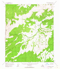
1952 Map of Livengood B-5
USGS Topo · Published 1963About this map
Sawtooth Mountain anchors this subarctic interior Alaskan landscape, surveyed shortly after the Second World War. The topography is defined by the winding Tolovana River and its numerous tributaries, including Starvation Creek, Chocolate Creek, and Moose Creek. These watercourses provided the primary transit corridors for the region's early 20th-century exploration and subsistence activities. Evidence of human presence is sparse but specific, with scattered Cabin and Cabins sites linked by a series of primitive Tractor Trails. A small Landing Strip near Montana Creek highlights the essential role of aviation in accessing this remote terrain. The land lines shown represent unsurveyed locations predetermined by the Bureau of Land Management, reflecting a period when much of the Alaskan interior remained a vast, officially unorganized frontier.
Find a feature on this map
20 named features on this map. Tap any name to fly to it.
Don’t see what you’re looking for? This feature index may not catch every label — zoom into the map to look around manually.
Map Details
Editions of this 1952 Livengood B-5 Map
3 editions found
Other maps of this area

1945 · Livengood
USGS Topo · 1:250,000

1951 · Livengood
USGS Topo · 1:250,000

1951 · Livengood A-5
USGS Topo · 1:63,360

1951 · Livengood A-4
USGS Topo · 1:63,360

1952 · Livengood A-6
USGS Topo · 1:63,360

1952 · Livengood C-5
USGS Topo · 1:63,360

1952 · Livengood B-5
USGS Topo · 1:63,360

1952 · Livengood C-4
USGS Topo · 1:63,360

1953 · Livengood B-4
USGS Topo · 1:63,360

1953 · Livengood A-4
USGS Topo · 1:63,360