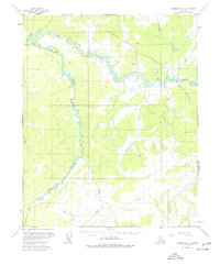
1952 Map of Livengood C-5
USGS Topo · Published 1977About this map
The Trans-Alaska Pipeline cuts a distinct path through this interior landscape during its 1970s construction phase, marking a major industrial shift in the wilderness. This survey is defined by the winding course of Hess Creek and the many tributaries that feed into it, including Troublesome Creek and the Mud Fork. While much of the terrain remains dominated by natural drainages like Richardson Creek and Mastodon Creek, the inclusion of the Elliott Highway on the eastern edge shows the primary artery connecting this remote region. In purple revisions from 1975, the map documents the physical footprint of the pipeline corridor, complete with associated Gravel Pits used for its development, providing a rare look at the infrastructure as it was being built.
Find a feature on this map
10 named features on this map. Tap any name to fly to it.
Don’t see what you’re looking for? This feature index may not catch every label — zoom into the map to look around manually.
Map Details
Editions of this 1952 Livengood C-5 Map
4 editions found
Other maps of this area

1945 · Livengood
USGS Topo · 1:250,000

1951 · Livengood
USGS Topo · 1:250,000

1952 · Livengood C-5
USGS Topo · 1:63,360

1952 · Livengood B-5
USGS Topo · 1:63,360

1952 · Livengood D-5
USGS Topo · 1:63,360

1952 · Livengood C-4
USGS Topo · 1:63,360

1953 · Livengood B-4
USGS Topo · 1:63,360

1953 · Livengood D-4
USGS Topo · 1:63,360

1954 · Livengood D-4
USGS Topo · 1:63,360

1954 · Livengood C-4
USGS Topo · 1:63,360