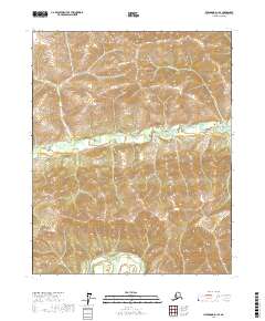
2017 Map of Livengood D-1 SE
USGS Topo · Published 2017About this map
Victoria Creek snakes across the central interior of this terrain, defining a drainage basin that includes Victoria Cr and Deadwood Cr. This northern landscape is characterized by its high-elevation topography and a complex network of seasonal and perennial waterways that have shaped the land over millennia. The absence of roads or permanent structures reflects the wilderness character of the region, where surveyors primarily recorded township and range boundaries such as t12n r3e and t11n r3e to organize the vast open space.
Find a feature on this map
11 named features on this map. Tap any name to fly to it.
Don’t see what you’re looking for? This feature index may not catch every label — zoom into the map to look around manually.
Map Details
Editions of this 2017 Livengood D-1 SE Map
This is the sole edition of this map. No revisions or reprints were ever made.
Other maps of this area

1945 · Livengood
USGS Topo · 1:250,000

1951 · Livengood
USGS Topo · 1:250,000

1951 · Circle
USGS Topo · 1:250,000

1951 · Circle D-6
USGS Topo · 1:63,360

1951 · Livengood C-1
USGS Topo · 1:63,360

1951 · Circle C-6
USGS Topo · 1:63,360

1952 · Livengood D-1
USGS Topo · 1:63,360

1954 · Livengood C-1
USGS Topo · 1:63,360

1954 · Circle D-6
USGS Topo · 1:63,360
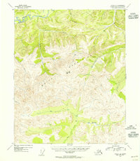
1954 · Circle C-6
USGS Topo · 1:63,360