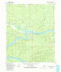
1956 Map of Livengood D-6
USGS Topo · Published 1993About this map
The Yukon River dominates this interior landscape, carving a wide, island-studded path past Sightas Island and Crescent Island. This 1956 survey, later updated with revisions through 1975, documents the essential infrastructure that opened the Alaskan wilderness. Modern industrial corridors like The Trans-Alaska Pipeline and the Dalton Highway cut through the terrain, contrasting with older routes such as the Winter Trail and the remote Landing Strip near the Ray River.
Find a feature on this map
27 named features on this map. Tap any name to fly to it.
Don’t see what you’re looking for? This feature index may not catch every label — zoom into the map to look around manually.
Map Details
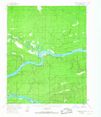
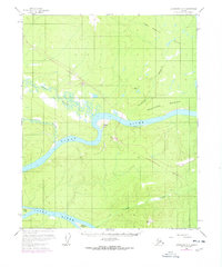
Editions of this 1956 Livengood D-6 Map
4 editions found

Other maps of this area

1945 · Livengood
USGS Topo · 1:250,000

1951 · Bettles
USGS Topo · 1:250,000

1951 · Tanana
USGS Topo · 1:250,000

1951 · Livengood
USGS Topo · 1:250,000

1951 · Beaver
USGS Topo · 1:250,000

1952 · Livengood C-5
USGS Topo · 1:63,360

1952 · Livengood D-5
USGS Topo · 1:63,360

1956 · Bettles
USGS Topo · 1:250,000

1956 · Beaver A-5
USGS Topo · 1:63,360

1956 · Tanana C-1
USGS Topo · 1:63,360