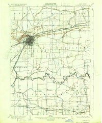
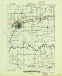
1902 Map of Lockport
USGS Topo · Published 1932About this map
Lockport serves as the industrial and transit anchor of this 1902 survey, where the heavy infrastructure of the Barge Canal and multiple rail lines converge. The landscape is defined by the rigid grid of the city contrasted with the winding course of Tonawanda Creek to the south. Smaller hamlets like Gasport, Reynales Basin, and Orangeport dot the canal corridor, illustrating the importance of waterway commerce in Niagara County at the turn of the century. Farther south, the rural character of the region is evident in the scattered settlements of Clarence Center and Wolcottsville, connected by established routes like Transit Road. The map reveals a highly developed network of transport, including the Electric R. R. and the Niagara Falls Line, which supported the movement of goods and people between the growing urban centers and the surrounding agricultural landscape.
Find a feature on this map
51 named features on this map. Tap any name to fly to it.
Don’t see what you’re looking for? This feature index may not catch every label — zoom into the map to look around manually.
Map Details
Editions of this 1902 Lockport Map
6 editions found

Other maps of this area

1894 · Buffalo
USGS Topo · 1:62,500

1894 · Wilson
USGS Topo · 1:62,500

1897 · Tonawanda
USGS Topo · 1:62,500

1897 · Olcott
USGS Topo · 1:62,500

1897 · Medina
USGS Topo · 1:62,500

1897 · Lockport
USGS Topo · 1:62,500

1897 · Ridgeway
USGS Topo · 1:62,500

1899 · Niagara
USGS Topo · 1:125,000

1900 · Wilson
USGS Topo · 1:62,500

1900 · Tonawanda
USGS Topo · 1:62,500