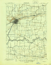
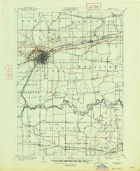
1902 Map of Lockport
USGS Topo · Published 1945About this map
Lockport serves as the industrial and hydraulic hub of this Niagara County landscape, where the Barge Canal (Erie Canal) carves through the bedrock at The Gulf. This late 19th-century survey highlights a region defined by the intersection of major water routes and the N. Y. C. and H. R. R. R. system. To the south, the meandering Tonawanda Creek forms a natural boundary between townships, supporting scattered agrarian hamlets like Millersport and Wolcottsville. The survey captures the transition of the canal era into the railroad age, noted by the presence of the Electric R. R. and the strategic positioning of depots at Transit Sta. and Gasport. Smaller family-named crossroads, including Mc Nalls and Hunts Corners, provide a clear picture of the local settlement patterns and rural economy before modern suburbanization altered the character of Clarence and Amherst.
Find a feature on this map
48 named features on this map. Tap any name to fly to it.
Don’t see what you’re looking for? This feature index may not catch every label — zoom into the map to look around manually.
Map Details
Editions of this 1902 Lockport Map
6 editions found

Other maps of this area

1894 · Buffalo
USGS Topo · 1:62,500

1894 · Wilson
USGS Topo · 1:62,500

1897 · Tonawanda
USGS Topo · 1:62,500

1897 · Olcott
USGS Topo · 1:62,500

1897 · Medina
USGS Topo · 1:62,500

1897 · Lockport
USGS Topo · 1:62,500

1897 · Ridgeway
USGS Topo · 1:62,500

1899 · Niagara
USGS Topo · 1:125,000

1900 · Wilson
USGS Topo · 1:62,500

1900 · Tonawanda
USGS Topo · 1:62,500