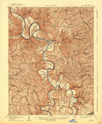
1908 Map of Lockport
USGS Topo · Published 1938About this map
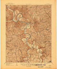
The Kentucky River carves a serpentine path through the borders of Owen, Henry, and Franklin counties, defining a landscape of sharp ridges and fertile river bottoms. These flatlands, such as Clements Bottom and Craddock Bottom, were the lifeblood of the local economy in the early 1900s. The river's navigability is marked by infrastructure like Lock No 2 and Lock No 3, while numerous river crossings like Manford Ferry and Johnson Ferry illustrate how communities remained connected before modern bridges were common.
Find a feature on this map
70 named features on this map. Tap any name to fly to it.
Don’t see what you’re looking for? This feature index may not catch every label — zoom into the map to look around manually.
Map Details
Editions of this 1908 Lockport Map
3 editions found
Other maps of this area

1906 · Lockport
USGS Topo · 1:48,000

1906 · Georgetown
USGS Topo · 1:62,500

1908 · Lockport
USGS Topo · 1:62,500

1908 · Georgetown
USGS Topo · 1:62,500

1922 · Frankfort
USGS Topo · 1:48,000

1923 · Waddy
USGS Topo · 1:48,000

1924 · Frankfort
USGS Topo · 1:62,500

1925 · Mount Eden
USGS Topo · 1:48,000

1927 · Mount Eden
USGS Topo · 1:62,500

1928 · New Castle
USGS Topo · 1:48,000