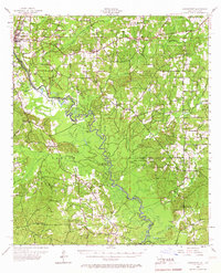
1956 Map of Logansport
USGS Topo · Published 1967About this map
The Sabine River forms the central spine of this mid-century landscape, acting as the border between Louisiana and Texas. The terrain is defined by a dense network of bayous and sloughs, such as Turkey Creek, Bull Bayou, and Tenaha Bayou, that feed into the main river channel. Within the Sabine National Forest, the map reveals a sparsely settled interior where small hubs like Lula and Pauls Store served local timber and agricultural interests.
Find a feature on this map
78 named features on this map. Tap any name to fly to it.
Don’t see what you’re looking for? This feature index may not catch every label — zoom into the map to look around manually.
Map Details
Editions of this 1956 Logansport Map
4 editions found

Other maps of this area

1941 · Zwolle
USGS Topo · 1:62,500

1941 · Pelican
USGS Topo · 1:62,500

1943 · Pleasant Hill
USGS Topo · 1:62,500

1944 · Logansport
USGS Topo · 1:62,500

1944 · Patroon
USGS Topo · 1:62,500

1944 · Zwolle
USGS Topo · 1:62,500

1944 · Pleasant Hill
USGS Topo · 1:62,500

1945 · Grand Cane
USGS Topo · 1:62,500

1945 · Socagee Bayou
USGS Topo · 1:62,500

1945 · Mansfield
USGS Topo · 1:62,500