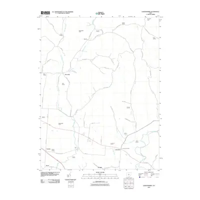
2010 Map of Londonderry
USGS Topo · Published 2010About this map
Londonderry and its surrounding rural hamlets are defined by a network of creeks and knobs in Ross County, Ohio. This 2010 survey illustrates a landscape where small settlements like Tucson, Mooresville, and Schooley are connected by a web of narrow lanes such as Possum Hollow Rd and Dunkard Hill Rd. The terrain is punctuated by distinctive high points, including Rattlesnake Knob and Point Lookout, while the Brush Ridge Lookout Tower stands as a significant landmark in the northeast. Genealogy interests are well-served by numerous small burial grounds, including the Schooley Station Cemetery and Charleston Cemetery. The intricate drainage system, featuring Walnut Creek and Salt Creek, dictates the placement of crossings like Jones Ford, reflecting the long-established relationship between the local geography and the rural infrastructure that supports these small Appalachian foothill communities.
Find a feature on this map
67 named features on this map. Tap any name to fly to it.
Don’t see what you’re looking for? This feature index may not catch every label — zoom into the map to look around manually.
Map Details
Editions of this 2010 Londonderry Map
This is the sole edition of this map. No revisions or reprints were ever made.
Other maps of this area

1906 · Waverly
USGS Topo · 1:62,500

1906 · Chillicothe
USGS Topo · 1:62,500

1908 · Chillicothe
USGS Topo · 1:62,500

1908 · Waverly
USGS Topo · 1:62,500

1910 · Laurelville
USGS Topo · 1:62,500

1912 · Laurelville
USGS Topo · 1:62,500

1913 · Jackson
USGS Topo · 1:62,500

1944 · Jackson
USGS Topo · 1:62,500

1944 · Laurelville
USGS Topo · 1:62,500

1947 · Columbus
USGS Topo · 1:250,000