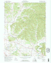
1992 Map of Londonderry
USGS Topo · Published 1995About this map
Londonderry serves as the primary hub in this corner of Ross County, situated at a junction where local life revolves around the valley of Salt Creek. The landscape transitions from the managed timberlands of the Tar Hollow State Forest in the northeast to the agricultural bottomlands near Schooley and Vigo. This 1990s record documents a series of small, potentially older communities like Tucson, Mooresville, and the colorfully named Lickskillet. Family history is deeply rooted here, evidenced by numerous burial grounds including Londonderry Cem, Timmons Cem, and Peecher Cem. The religious life of the townships is marked by several country sanctuaries such as Poe Run Ch and the Kingdom of Heaven Ch. These landmarks, along with the old Harrison Sch, provide a detailed look at the social geography of the area before modern development altered the rural character.
Find a feature on this map
51 named features on this map. Tap any name to fly to it.
Don’t see what you’re looking for? This feature index may not catch every label — zoom into the map to look around manually.
Map Details
Editions of this 1992 Londonderry Map
This is the sole edition of this map. No revisions or reprints were ever made.
Other maps of this area

1906 · Waverly
USGS Topo · 1:62,500

1906 · Chillicothe
USGS Topo · 1:62,500

1908 · Chillicothe
USGS Topo · 1:62,500

1908 · Waverly
USGS Topo · 1:62,500

1910 · Laurelville
USGS Topo · 1:62,500

1912 · Laurelville
USGS Topo · 1:62,500

1913 · Jackson
USGS Topo · 1:62,500

1944 · Jackson
USGS Topo · 1:62,500

1944 · Laurelville
USGS Topo · 1:62,500

1947 · Columbus
USGS Topo · 1:250,000