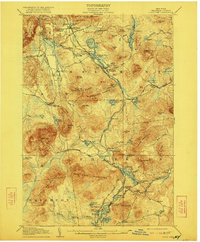
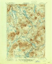
1908 Map of Loon Lake
USGS Topo · Published 1922About this map
Mountain View and the surrounding Adirondack wilderness define this early 20th-century topographic survey, where the New York Central and Hudson River and Delaware and Hudson railroads intersect. This period was a critical era for the region's logging and tourism industries, evidenced by industrial sites like Upper Kilns and the Middle Kilns, as well as established lodges such as Hunter Home.
Find a feature on this map
101 named features on this map. Tap any name to fly to it.
Don’t see what you’re looking for? This feature index may not catch every label — zoom into the map to look around manually.
Map Details
Editions of this 1908 Loon Lake Map
6 editions found
Other maps of this area

1896 · Lake Placid
USGS Topo · 1:62,500

1898 · Lake Placid
USGS Topo · 1:62,500

1902 · Saranac
USGS Topo · 1:62,500

1904 · Saranac
USGS Topo · 1:62,500

1905 · Saint Regis
USGS Topo · 1:62,500

1906 · Loon Lake
USGS Topo · 1:62,500

1908 · Loon Lake
USGS Topo · 1:62,500

1911 · Lyon Mountain
USGS Topo · 1:62,500

1913 · Lyon Mountain
USGS Topo · 1:62,500

1915 · Churubusco
USGS Topo · 1:62,500