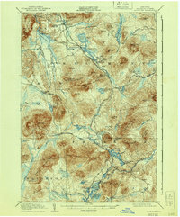
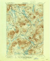
1908 Map of Loon Lake
USGS Topo · Published 1940About this map
Salmon River headwaters and a complex network of turn-of-the-century railroads define this portion of the northern Adirondacks. The map captures the intersection of multiple rail lines, including the New York Central and Hudson River Railroad and the Delaware and Hudson Railroad, which serviced the seasonal tourism and local industries of the day. Early settlements and post offices like Loon Lake PO and Inman PO appear alongside significant transportation corridors like the Port Kent and Hopkinton Turnpike. The landscape is dominated by named ranges such as the Plumadore Range and the Goldsmith Mtns, interspersed with numerous high-altitude water bodies including Ragged Lake and Mountain View Lake. These labels reflect the early 1900s transition from a timber-driven economy to one focused on recreation and sport, evidenced by landmarks like Hunter Home and Walker Mill.
Find a feature on this map
114 named features on this map. Tap any name to fly to it.
Don’t see what you’re looking for? This feature index may not catch every label — zoom into the map to look around manually.
Map Details
Editions of this 1908 Loon Lake Map
6 editions found
Other maps of this area

1896 · Lake Placid
USGS Topo · 1:62,500

1898 · Lake Placid
USGS Topo · 1:62,500

1902 · Saranac
USGS Topo · 1:62,500

1904 · Saranac
USGS Topo · 1:62,500

1905 · Saint Regis
USGS Topo · 1:62,500

1906 · Loon Lake
USGS Topo · 1:62,500

1908 · Loon Lake
USGS Topo · 1:62,500

1911 · Lyon Mountain
USGS Topo · 1:62,500

1913 · Lyon Mountain
USGS Topo · 1:62,500

1915 · Churubusco
USGS Topo · 1:62,500