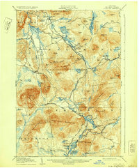
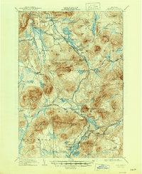
1908 Map of Loon Lake
USGS Topo · Published 1931About this map
The Owls Head Range and Goldsmith Range dominate this portion of the Adirondacks, where early 20th-century life centered on a dual economy of timber and seasonal tourism. Industrial activity is concentrated at Upper Kilns and Middle Kilns, while the New York Central and Hudson River Railroad and the Delaware and Hudson Railroad provide essential transport through the mountain passes. The landscape is defined by its numerous water bodies, from Ragged Lake to the complex of ponds near Loon Lake PO. Settlements like Mountain View and Barnesville illustrate the cluster of activity along the rail lines and the Salmon River. Historic travel routes, including the Port Kent and Hopkinton Turnpike, cross the terrain, connecting remote outposts like Hunter Home and Merrillville to the larger region.
Find a feature on this map
112 named features on this map. Tap any name to fly to it.
Don’t see what you’re looking for? This feature index may not catch every label — zoom into the map to look around manually.
Map Details
Editions of this 1908 Loon Lake Map
6 editions found
Other maps of this area

1896 · Lake Placid
USGS Topo · 1:62,500

1898 · Lake Placid
USGS Topo · 1:62,500

1902 · Saranac
USGS Topo · 1:62,500

1904 · Saranac
USGS Topo · 1:62,500

1905 · Saint Regis
USGS Topo · 1:62,500

1906 · Loon Lake
USGS Topo · 1:62,500

1908 · Loon Lake
USGS Topo · 1:62,500

1911 · Lyon Mountain
USGS Topo · 1:62,500

1913 · Lyon Mountain
USGS Topo · 1:62,500

1915 · Churubusco
USGS Topo · 1:62,500