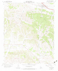
1959 Map of Los Alamos
USGS Topo · Published 1984About this map
The town of Los Alamos anchors the northern reaches of this mid-century survey, situated within the fertile Los Alamos Valley along San Antonio Creek. At this time, the settlement remains a concentrated agricultural and transport hub, with the Los Alamos Cem located just south of the main townsite. The topography is dominated by several distinct ranges, including the Purisima Hills and the Santa Rosa Hills, which create a complex network of canyons and ridges. A network of primitive Jeep Trails and ranch roads, such as Mail Road, wind through the southern peaks.
Find a feature on this map
38 named features on this map. Tap any name to fly to it.
Don’t see what you’re looking for? This feature index may not catch every label — zoom into the map to look around manually.
Map Details
Editions of this 1959 Los Alamos Map
4 editions found
Other maps of this area

1905 · Lompoc
USGS Topo · 1:125,000

1942 · Lompoc
USGS Topo · 1:125,000

1942 · Lompoc
USGS Topo · 1:62,500

1942 · Santa Maria
USGS Topo · 1:62,500

1942 · Tepusquet Peak
USGS Topo · 1:62,500

1942 · Los Olivos
USGS Topo · 1:62,500

1943 · Los Olivos
USGS Topo · 1:62,500

1943 · Tepusquet Peak
USGS Topo · 1:62,500

1943 · Lompoc
USGS Topo · 1:125,000

1947 · Lompoc
USGS Topo · 1:24,000