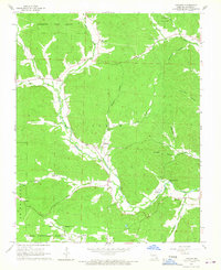
1965 Map of Lowndes
USGS Topo · Published 1967About this map
Coldwater State Forest and the northern reaches of the Clark National Forest dominate the timbered uplands of this mid-1960s survey. The landscape is defined by the winding course of Bear Creek, which creates a narrow valley of cleared bottomland for small settlements like Clubb, Hiram, and Lowndes. These communities follow the water and the roads that thread through the surrounding Ozark ridges, often centered around local institutions like Hiram Sch and the Wesley Chapel.
Find a feature on this map
37 named features on this map. Tap any name to fly to it.
Don’t see what you’re looking for? This feature index may not catch every label — zoom into the map to look around manually.
Map Details
Editions of this 1965 Lowndes Map
3 editions found
Other maps of this area

1930 · Coldwater
USGS Topo · 1:62,500

1933 · Marquand
USGS Topo · 1:62,500

1934 · Greenville
USGS Topo · 1:62,500

1935 · Zalma
USGS Topo · 1:62,500

1938 · Marquand
USGS Topo · 1:62,500

1939 · Greenville
USGS Topo · 1:62,500

1939 · Zalma
USGS Topo · 1:62,500

1949 · Rolla
USGS Topo · 1:250,000

1949 · Coldwater
USGS Topo · 1:62,500

1953 · Rolla
USGS Topo · 1:250,000