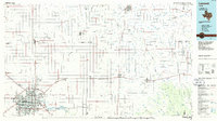
1986 Map of Lubbock
USGS Topo · Published 1986About this map
The High Plains landscape of the Texas Panhandle is captured here through a grid of agricultural section lines and pioneering settlements. Lubbock serves as the regional hub, showing a complex network of urban development, the International Airport, and radiating rail lines including the Atchison Topeka and Santa Fe and Burlington Northern. Beyond the city, the terrain is defined by the dramatic cuts of the White Blanco Canyon River and Yellow House Canyon, where the flat Llano Estacado gives way to more varied relief and water features like Buffalo Springs Lake. Smaller, specialized communities such as Estacado, Heckville, and Becton provide insight into the rural economy and land use during the mid-1980s. The map also records early water sources and landmarks critical to the area's development, including Indian Hill Springs and Big Squaw Spring, set against a backdrop of numerous small quarries and municipal airfields.
Find a feature on this map
88 named features on this map. Tap any name to fly to it.
Don’t see what you’re looking for? This feature index may not catch every label — zoom into the map to look around manually.
Map Details
Editions of this 1986 Lubbock Map
2 editions found
Other maps of this area

1954 · Lubbock
USGS Topo · 1:250,000

1954 · Plainview
USGS Topo · 1:250,000

1954 · Clovis
USGS Topo · 1:250,000

1954 · Brownfield
USGS Topo · 1:250,000

1956 · Shallowater
USGS Topo · 1:24,000

1956 · New Deal
USGS Topo · 1:24,000

1957 · Lubbock East
USGS Topo · 1:24,000

1957 · New Home
USGS Topo · 1:62,500

1957 · Lubbock West
USGS Topo · 1:24,000

1957 · Lubbock
USGS Topo · 1:62,500