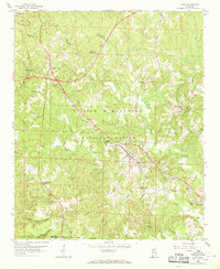
1958 Map of Lynn
USGS Topo · Published 1969About this map
Lynn and Natural Bridge serve as the primary hubs in this late 1950s landscape, where the Southern railroad line cuts a diagonal path through the northern reaches of the William B Bankhead National Forest. The geography is defined by a dense network of watercourses, including Splunge Creek and Blackwater Creek, which underscore the rural character of the area. Significant historical infrastructure is visible in the form of Byler Road and the Yankee Trace, hinting at earlier migration and transport corridors through Winston and Walker counties. The map provides excellent detail for genealogists, marking numerous community landmarks such as Philadelphia Ch, Sardis Ch, and Tittle Cem. Local industry is evidenced by scattered Strip Mines and Gravel Pits, reflecting the extraction economy that operated alongside small settlements like Glen Mary and Ashbank.
Find a feature on this map
38 named features on this map. Tap any name to fly to it.
Don’t see what you’re looking for? This feature index may not catch every label — zoom into the map to look around manually.
Map Details
Editions of this 1958 Lynn Map
3 editions found
Other maps of this area

1893 · Jasper
USGS Topo · 1:125,000

1936 · Delmar
USGS Topo · 1:24,000

1936 · Goddard
USGS Topo · 1:24,000

1949 · Nauvoo
USGS Topo · 1:24,000

1950 · Nauvoo
USGS Topo · 1:24,000

1953 · Birmingham
USGS Topo · 1:250,000

1956 · Birmingham
USGS Topo · 1:250,000

1956 · Gadsden
USGS Topo · 1:250,000

1957 · Birmingham
USGS Topo · 1:250,000

1958 · Gadsden
USGS Topo · 1:250,000