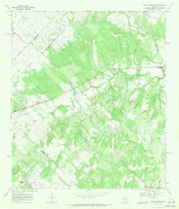
1968 Map of Lytton Springs
USGS Topo · Published 1971About this map
Lytton Springs and the surrounding ranchlands of Bastrop and Caldwell counties appear here at the end of the 1960s, defined by a landscape of rolling creeks and rural community centers. The map shows a clear concentration of civic life around Saint Marys Ch and its accompanying Saint Marys Community Center, while the presence of the U S Military Reservation and National Guard Armory indicates the area's strategic role during this era.
Find a feature on this map
26 named features on this map. Tap any name to fly to it.
Don’t see what you’re looking for? This feature index may not catch every label — zoom into the map to look around manually.
Map Details
Editions of this 1968 Lytton Springs Map
3 editions found
Other maps of this area

1885 · Bastrop
USGS Topo · 1:125,000

1893 · Bastrop
USGS Topo · 1:125,000

1896 · Austin
USGS Topo · 1:125,000

1897 · Austin
USGS Topo · 1:125,000

1901 · Flatonia
USGS Topo · 1:125,000

1904 · Bastrop
USGS Topo · 1:125,000

1910 · Austin
USGS Topo · 1:125,000

1911 · San Marcos
USGS Topo · 1:125,000

1919 · San Marcos
USGS Topo · 1:125,000

1930 · Lockhart
USGS Topo · 1:62,500