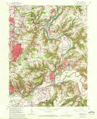
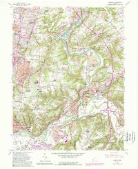
1961 Map of Madeira
USGS Topo · Published 1971About this map
The Little Miami River and its East Fork define this suburban landscape, where the established rail corridors of the Penn Central and Norfolk and Western railroads bisect residential expansion. By the early 1970s, many distinct communities such as Madeira, Montgomery, and Mariemont show dense residential street grids, while family names and land use persist in features like Jones Farm and the Terrace Park Country Club. The map documents a significant concentration of local heritage sites, including the United Cem near Hopewell Ch and the Sacred Heart Novitiate in Milford. Extensive gravel extraction is visible along the riverbanks near Ancor and Camp Dennison, marking the industrial footprint of the river valley alongside emerging housing developments like Fairwind Acres and Summerside Estates.
Find a feature on this map
85 named features on this map. Tap any name to fly to it.
Don’t see what you’re looking for? This feature index may not catch every label — zoom into the map to look around manually.
Map Details
Editions of this 1961 Madeira Map
5 editions found
Other maps of this area

1898 · East Cincinnati
USGS Topo · 1:62,500

1904 · Mason
USGS Topo · 1:62,500

1906 · Mason
USGS Topo · 1:62,500

1914 · East Cincinnati
USGS Topo · 1:62,500

1914 · Batavia
USGS Topo · 1:48,000

1914 · Morrow
USGS Topo · 1:62,500

1916 · Batavia
USGS Topo · 1:62,500

1916 · Morrow
USGS Topo · 1:62,500

1952 · Newport
USGS Topo · 1:24,000

1953 · Withamsville
USGS Topo · 1:24,000