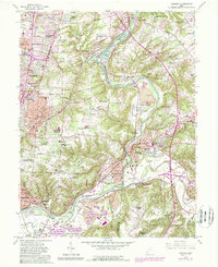
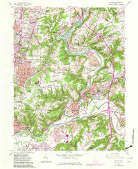
1961 Map of Madeira
USGS Topo · Published 1988About this map
Indian Hill and the surrounding eastern suburbs of Cincinnati undergo significant mid-century suburbanization as seen in this 1961 record, revised in the late 1980s. The Little Miami River serves as a natural corridor for both geography and transit, flanked by the Pennsylvania RR and Baltimore and Ohio RR. The map illustrates the growth of established communities like Madeira, Milford, and Terrace Park alongside newer residential developments such as Montgomery Heights and North Clippinger.
Find a feature on this map
107 named features on this map. Tap any name to fly to it.
Don’t see what you’re looking for? This feature index may not catch every label — zoom into the map to look around manually.
Map Details
Editions of this 1961 Madeira Map
5 editions found
Other maps of this area

1898 · East Cincinnati
USGS Topo · 1:62,500

1904 · Mason
USGS Topo · 1:62,500

1906 · Mason
USGS Topo · 1:62,500

1914 · East Cincinnati
USGS Topo · 1:62,500

1914 · Batavia
USGS Topo · 1:48,000

1914 · Morrow
USGS Topo · 1:62,500

1916 · Batavia
USGS Topo · 1:62,500

1916 · Morrow
USGS Topo · 1:62,500

1952 · Newport
USGS Topo · 1:24,000

1953 · Withamsville
USGS Topo · 1:24,000