
1957 Map of Mahomet
USGS Topo · Published 1958About this map
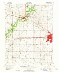
The Sangamon River meanders through the heart of this landscape, flanked by the County Forest Preserve and several recreational landmarks like Lake of the Woods and Mallory Park. The mid-century expansion of Champaign is evident along its western edge, where neighborhoods surround schools like Franklin Jr High Sch and Howard Sch. Further south, the University of Illinois Airport and a prominent Beacon reflect the area's role as a regional aviation and transportation hub during the late 1950s.
Find a feature on this map
79 named features on this map. Tap any name to fly to it.
Don’t see what you’re looking for? This feature index may not catch every label — zoom into the map to look around manually.
Map Details
Editions of this 1957 Mahomet Map
2 editions found
Other maps of this area

1906 · Urbana
USGS Topo · 1:62,500

1907 · Mahomet
USGS Topo · 1:62,500

1924 · Paxton
USGS Topo · 1:62,500

1927 · Paxton
USGS Topo · 1:62,500

1928 · Gibson City
USGS Topo · 1:62,500

1937 · Monticello
USGS Topo · 1:48,000

1943 · Monticello
USGS Topo · 1:62,500

1949 · Paxton
USGS Topo · 1:62,500

1950 · Tuscola
USGS Topo · 1:62,500

1952 · Arrowsmith
USGS Topo · 1:62,500