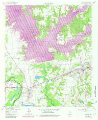
1960 Map of Malakoff
USGS Topo · Published 1982About this map
The Trinity River and the massive Cedar Creek Reservoir dominate this 1960s Texas landscape, capturing the region's mid-century transformation through water management and industrialization. The St Louis Southwestern railroad serves as the primary artery connecting Trinidad to Malakoff, passing through a landscape defined by utility and extraction, from the Powerplant Substa near Trinidad Lake to the extensive Claypits and Gravel Pit operations. Social centers like the St Paul Industrial Sch and the Mankin Ch offer vital touchpoints for local historians and genealogists, while the development of Star Harbor and Caney City along the reservoir's fingers shows the emerging recreational character of the Henderson County lakefront. The map also preserves the site of the Antioch Cem and the complex hydrology of McAllister Slough and Flag Lake before modern shoreline stabilization.
Find a feature on this map
37 named features on this map. Tap any name to fly to it.
Don’t see what you’re looking for? This feature index may not catch every label — zoom into the map to look around manually.
Map Details
Editions of this 1960 Malakoff Map
4 editions found

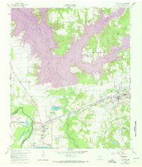
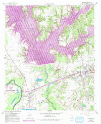
Other maps of this area

1920 · Kemp
USGS Topo · 1:62,500

1948 · Martins Mill
USGS Topo · 1:62,500

1949 · Martins Mill
USGS Topo · 1:62,500

1949 · Athens
USGS Topo · 1:62,500

1950 · Athens
USGS Topo · 1:62,500

1954 · Dallas
USGS Topo · 1:250,000

1956 · Tyler
USGS Topo · 1:250,000

1957 · Kemp
USGS Topo · 1:62,500

1958 · Dallas
USGS Topo · 1:250,000

1960 · Tool
USGS Topo · 1:24,000