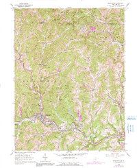
1960 Map of Mannington
USGS Topo · Published 1991About this map
The hills and deep-cut valleys of northwestern Marion County are defined by a complex extractive landscape, where industrial infrastructure weaves through rural communities. In Mannington, the Baltimore and Ohio railroad follows the curve of Buffalo Creek, serving as a vital corridor for the region's coal and gas production. Numerous Gas Wells are scattered across the ridges, particularly near Bake Oven Knob and along the waters of Pyles Fork.
Find a feature on this map
68 named features on this map. Tap any name to fly to it.
Don’t see what you’re looking for? This feature index may not catch every label — zoom into the map to look around manually.
Map Details
Editions of this 1960 Mannington Map
3 editions found
Other maps of this area

1902 · Clarksburg
USGS Topo · 1:62,500

1902 · Fairmont
USGS Topo · 1:62,500

1904 · Blacksville
USGS Topo · 1:62,500

1905 · Mannington
USGS Topo · 1:62,500

1910 · Clarksburg
USGS Topo · 1:62,500

1923 · Blacksville
USGS Topo · 1:62,500

1923 · Fairmont
USGS Topo · 1:62,500

1923 · Mannington
USGS Topo · 1:62,500

1923 · Clarksburg
USGS Topo · 1:62,500

1925 · Blacksville
USGS Topo · 1:62,500