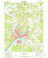
1969 Map of Marietta
USGS Topo · Published 1977About this map
Marietta and Williamstown anchor this river-confluence landscape where the Muskingum River meets the Ohio River at the West Virginia border. The map illustrates a dense concentration of civic history in Marietta, including the Campus Martius Museum, the Fort Harmar Monument, and Marietta College. The urban layout follows a grid along historic thoroughfares like Front St and Putnam St, while the surrounding terrain is marked by the steep ridges of Wayne National Forest.
Find a feature on this map
113 named features on this map. Tap any name to fly to it.
Don’t see what you’re looking for? This feature index may not catch every label — zoom into the map to look around manually.
Map Details
Editions of this 1969 Marietta Map
3 editions found
Other maps of this area

1902 · Parkersburg
USGS Topo · 1:62,500

1903 · Macksburg
USGS Topo · 1:62,500

1904 · Parkersburg
USGS Topo · 1:62,500

1904 · Marietta
USGS Topo · 1:62,500

1905 · Macksburg
USGS Topo · 1:62,500

1909 · Caldwell
USGS Topo · 1:62,500

1912 · Caldwell
USGS Topo · 1:62,500

1924 · Marietta
USGS Topo · 1:62,500

1927 · Marietta
USGS Topo · 1:62,500

1949 · Clarksburg
USGS Topo · 1:250,000