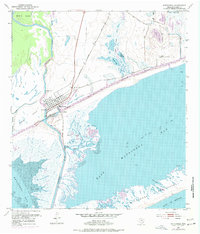
1952 Map of Matagorda
USGS Topo · Published 1977About this map
The Colorado River delta dominates this coastal survey, where the town of Matagorda sits at the nexus of several vital shipping and transit corridors. By the early 1950s, the Intracoastal Waterway had been engineered across the landscape, cutting through Baxter Island and providing a protected passage for commercial vessels. The map shows the Atchison Topeka and Santa Fe railroad line terminating just north of the settlement, emphasizing the community's role as a regional transport hub where rail, river, and sea traffic met.
Find a feature on this map
31 named features on this map. Tap any name to fly to it.
Don’t see what you’re looking for? This feature index may not catch every label — zoom into the map to look around manually.
Map Details
Editions of this 1952 Matagorda Map
4 editions found
Other maps of this area

1951 · Bay City
USGS Topo · 1:250,000

1952 · Palacios SE
USGS Topo · 1:24,000

1952 · Lake Austin
USGS Topo · 1:24,000

1952 · Matagorda
USGS Topo · 1:24,000

1952 · Blessing SE
USGS Topo · 1:24,000

1952 · Dressing Point
USGS Topo · 1:24,000
1952 · Matagorda SW
USGS Topo · 1:24,000

1952 · Palacios NE
USGS Topo · 1:24,000

1952 · Wadsworth
USGS Topo · 1:24,000

1953 · Beeville
USGS Topo · 1:250,000