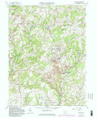
1964 Map of Mc Intyre
USGS Topo · Published 1982About this map
Mc Intyre and the surrounding Indiana County landscape in the mid-1960s were defined by a heavy industrial footprint and a dense network of small coal towns. The map reveals an area transitioning through extensive surface mining, with prominent Strip Mines and numerous gas wells scattered across the hillsides of South Bend and Young townships. Many of these settlements are intrinsically tied to the local infrastructure, such as Coal Run (Clune PO) and Jacksonville (Kent PO), reflecting the dual identity of post office locations within mining hubs.
Find a feature on this map
46 named features on this map. Tap any name to fly to it.
Don’t see what you’re looking for? This feature index may not catch every label — zoom into the map to look around manually.
Map Details
Editions of this 1964 Mc Intyre Map
4 editions found
Other maps of this area

1900 · Latrobe
USGS Topo · 1:62,500

1902 · Latrobe
USGS Topo · 1:62,500

1902 · Indiana
USGS Topo · 1:62,500

1902 · Elders Ridge
USGS Topo · 1:62,500

1903 · Latrobe
USGS Topo · 1:62,500

1904 · Elders Ridge
USGS Topo · 1:62,500

1920 · New Florence
USGS Topo · 1:62,500

1921 · New Florence
USGS Topo · 1:48,000

1922 · New Florence
USGS Topo · 1:62,500

1944 · New Florence
USGS Topo · 1:62,500
Featured Places
- Black Lick Township, PA
- South Bend Township, PA
- Young Township, PA
- Jacksonville, Black Lick Township
- Conemaugh Township, PA