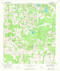
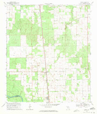
1969 Map of McAlpin
USGS Topo · Published 1971About this map
The Seaboard Coast Line railroad cuts diagonally across this Suwannee County landscape, anchoring rural communities like McAlpin and Pine Mount. The area is defined by its numerous water bodies, ranging from the large Peacock Lake in the northeast to smaller sinks and ponds like Blue Lake and Bandy Lake. A network of unpaved roads and property lines connects several country churches, including Mt Moriah Ch and Bethlehem Ch, which served the scattered farming families of the late 1960s.
Find a feature on this map
39 named features on this map. Tap any name to fly to it.
Don’t see what you’re looking for? This feature index may not catch every label — zoom into the map to look around manually.
Map Details
Editions of this 1969 McAlpin Map
3 editions found
Other maps of this area

1954 · Valdosta
USGS Topo · 1:250,000

1955 · Mayo NE
USGS Topo · 1:24,000

1955 · Mayo SE
USGS Topo · 1:24,000

1958 · Valdosta
USGS Topo · 1:250,000

1959 · Valdosta
USGS Topo · 1:250,000

1959 · Live Oak West
USGS Topo · 1:24,000

1961 · Live Oak East
USGS Topo · 1:24,000

1961 · White Springs West
USGS Topo · 1:24,000
1969 · Wellborn
USGS Topo · 1:24,000
1969 · O'Brien
USGS Topo · 1:24,000