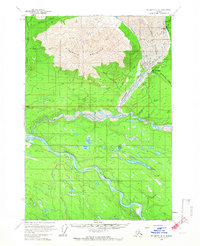
1959 Map of McCarthy B-6
USGS Topo · Published 1966About this map
McCarthy and Blackburn sit at the edge of the massive Kennicott Glacier, serving as key points of human activity during this late 1950s survey. The landscape is defined by the braided channels of the Nizina River and Chitina River, which dominate the central and southern portions of the map. Evidence of the region's industrial and transportation history is clear from the Old Railroad Grade and various Tractor Trails that cross the terrain. The presence of Cem and Graves near the settlements, along with scattered Cabins, provides a localized view of the resident population. High above the river valleys, Fireweed Mountain anchors the northern topography, overlooking smaller water bodies like Camel Lake and Wheat Lake that dot the lower elevations between the major river forks.
Find a feature on this map
28 named features on this map. Tap any name to fly to it.
Don’t see what you’re looking for? This feature index may not catch every label — zoom into the map to look around manually.
Map Details
Editions of this 1959 McCarthy B-6 Map
4 editions found
Other maps of this area

1951 · McCarthy
USGS Topo · 1:250,000

1959 · McCarthy B-6
USGS Topo · 1:63,360

1959 · McCarthy C-5
USGS Topo · 1:63,360

1959 · McCarthy B-5
USGS Topo · 1:63,360

1959 · McCarthy A-5
USGS Topo · 1:63,360

1959 · McCarthy A-6
USGS Topo · 1:63,360

1959 · McCarthy C-6
USGS Topo · 1:63,360

1959 · McCarthy A-7
USGS Topo · 1:63,360

1959 · McCarthy C-7
USGS Topo · 1:63,360

1959 · McCarthy B-7
USGS Topo · 1:63,360