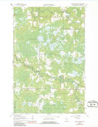
1964 Map of Meadow Brook
USGS Topo · Published 1986About this map
The Little Fork River meanders across the northern reaches of this landscape, punctuated by Hannine Falls and localized Rapids. This 1964 survey reveals a region largely defined by its protected woodlands, with the Sturgeon River State Forest and the Superior National Forest covering much of the terrain. The small settlement at Meadow Brook serves as a focal point near the eponymous creek, while the Sturgeon River Chapel provides a key landmark for genealogists tracing local families in the Sturgeon and Morcom townships. The map documents the presence of the Sturgeon River as it winds through the central and southern sections, joined by tributaries such as Sand Creek and Gilmore Creek. Evidence of local industry is limited to a few scattered Gravel Pits, reflecting a quiet, timber-and-water-based economy during the mid-1960s.
Find a feature on this map
17 named features on this map. Tap any name to fly to it.
Don’t see what you’re looking for? This feature index may not catch every label — zoom into the map to look around manually.
Map Details
Editions of this 1964 Meadow Brook Map
2 editions found
Other maps of this area

1954 · Hibbing
USGS Topo · 1:250,000

1955 · Dark Lake
USGS Topo · 1:24,000

1955 · Dewey Lake NW
USGS Topo · 1:24,000

1957 · Hibbing
USGS Topo · 1:250,000

1958 · Hibbing
USGS Topo · 1:250,000

1964 · Hibbing
USGS Topo · 1:250,000

1964 · Side Lake
USGS Topo · 1:24,000

1964 · Linden Grove
USGS Topo · 1:24,000

1964 · Gheen NW
USGS Topo · 1:24,000

1964 · Gheen
USGS Topo · 1:24,000